
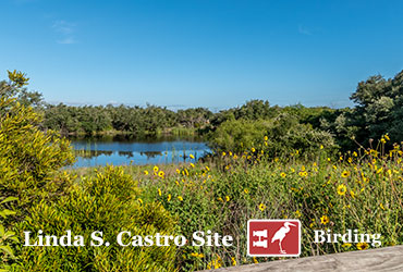
Birding
Birding Sites while you’re here with many resident and migratory birds.
Click Here for Birding Sites
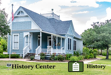
History
The Aransas County History Center can take you on a journey of days gone by.
More than 50 historical
markers and interpretative signs highlight the county’s rich and varied history.
Click Here for History Sites
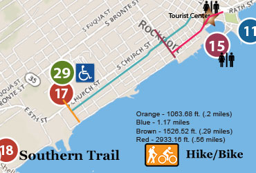
Hike & Bike
Numerous hiking and biking trails await your discovery in Aransas County.
List of Hike & Bike trails. Bring a map, extra food and water, and enjoy the scenic outdoors.
Click Here for Hike/Bike Sites
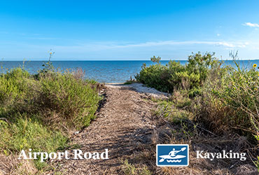
Kayaking
Access a multitude of shallow water bays surrounding the Rockport-Fulton area.
List of launch sites that provide accessible day trips.
Click Here for Kayaking Sites
What are your Pathways?
Yes – all this is available in Rockport, Fulton and Aransas County.
The best part about all of these activities is that they are free and available to everyone.
Aransas County, located in the southern part of Texas, offers a plethora of outdoor activities for nature enthusiasts. One can discover the wonders of nature by exploring historical sites, kayaking along the coastline, visiting birding sites, or biking and hiking on trails. Some non-Aransas Pathways sites charge a fee.
Rockport, Fulton & Aransas County are home to several historical sites. These sites offer a glimpse into the rich history of the area and the cultural heritage of the people who have called it home.
Birding is also a popular pastime in Aransas County, which is home to many birding sites. Aransas County is home to over 400 species of birds, including the endangered whooping crane (November thru April), and is a must-visit destination for birding enthusiasts.
Hiking and biking trails are another excellent way to experience the natural beauty of Aransas County. Kayaking, Hiking and Biking along the coastline is another excellent way to experience the natural beauty of the area. The area is home to a variety of marine life, including dolphins and sea turtles.
Whether you are a seasoned nature enthusiast or just looking for a fun and educational day trip, Aransas County has something to offer. So pack your bags, grab your bike & hiking shoes, and get ready to discover the wonders of nature in Aransas County, Texas.
Featured Aransas Pathways Sites
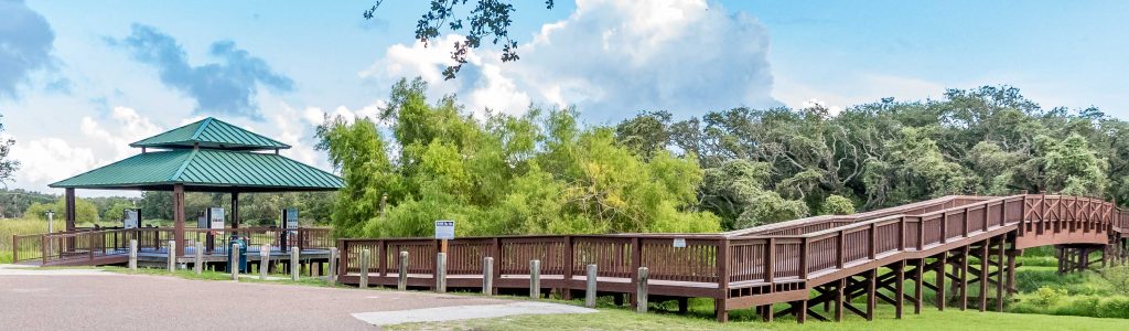
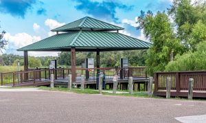
Pathways Center – Pavilion & Bridge (Tule West)
2491 Hwy 35 N., Rockport, TX 78382 (see map) The pavilion, called “Pathways Center ” is the principal information center for all of the Aransas…
New Information Kiosk installed
Location: 28.023579, -97.052385, intersection of Live Oak and North streets, on the west side of the parking lot surrounding the railroad depot in downtown Rockport….
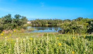
Linda S. Castro Nature Sanctuary
4140 Hwy 35 N., Rockport, TX 78382 (map below) This 4 1/2 acres contain 3 distinct habitats…a live oak motte, a remnant of a coastal…
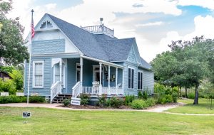
History Center for Aransas County
801 E Cedar St, Rockport, TX 78382 (see map) The History Center for Aransas County showcases local heritage. Outdoor and indoor exhibits tell the stories…
Current News & Events
- (no title)
- Healing Hands of Aransas County – Grand OpeningThe Friends of the History Center are pleased to announce the grand opening of the “Healing Hands of Aransas County” exhibit. When: January 20, 2024
- NEWS RELEASE: Aransas Pathways Volunteer Training DayWe are so thankful for our Volunteers! Come hep us restore our Aransas County Pathways. Bring your garden gloves, wear good shoes and work clothes.

We are so thankful for our Aransas County Pathways Volunteers! Come help us restore our Aransas County Pathways. Bring water, your favorite tools, and garden gloves. Dress for the weather and wear closed-toe shoes.
Interested in volunteering? Contact us, pathways@aransascounty.org or call 361-556-5308, if you have questions.
Click here to view our currently posted dates.
Did you Volunteer at one of our sites?
Click here to complete a short form to help us to continue to recognize our volunteers.